


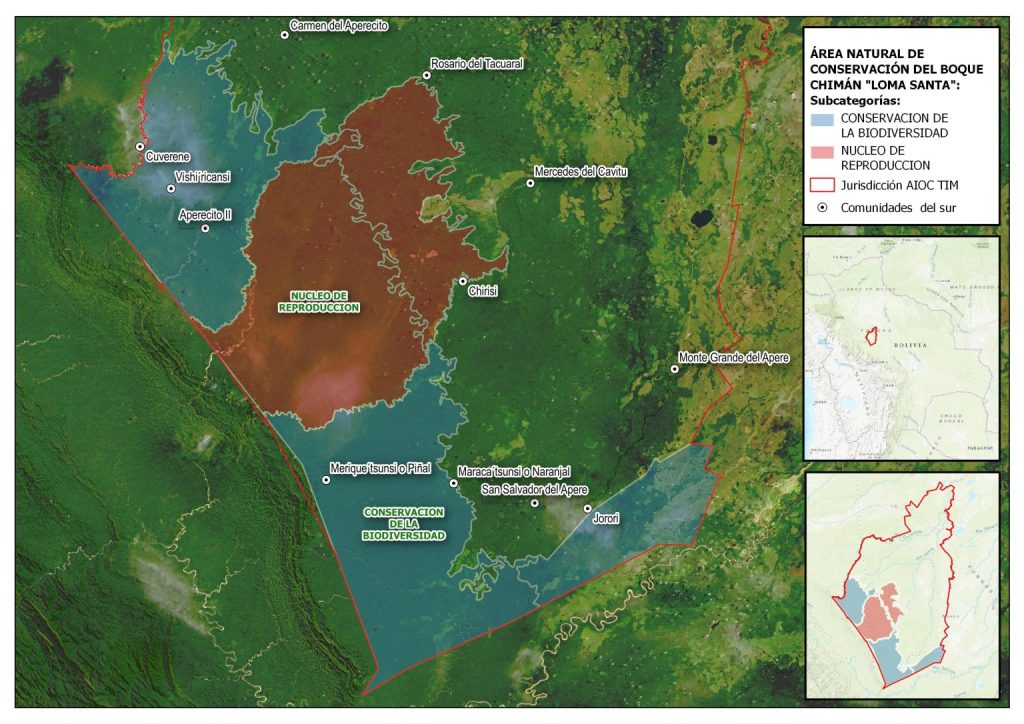
The Multiethnic Indigenous Territory (MIT) extends over half a million hectares of land located between the provinces of Mojos and Yacuma, in the department of Beni. Of that amount, 41% corresponds to the Loma Santa Conservation Area, which in its 206,211 hectares conserves water sources, Amazon forest and floodplains, as well as a wide variety of species of fauna and flora.
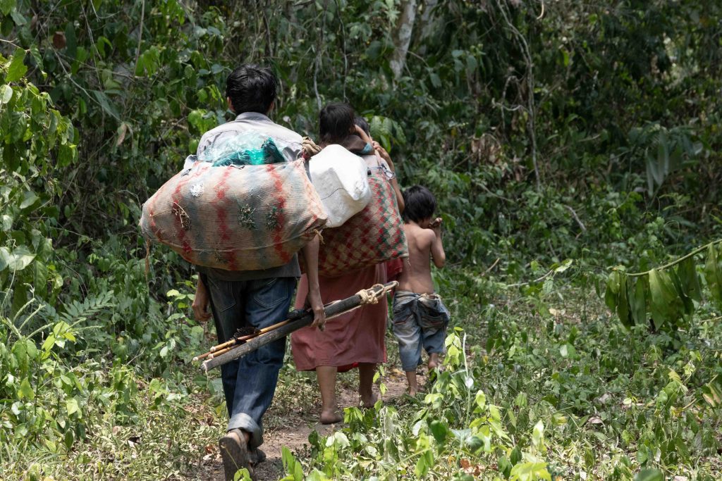
“This is a key area of water recharge, it takes the place of the springs and the best-preserved forest, as well as the most vulnerable indigenous communities that are the T’simanes. It is an autonomous conservation area of the MIT. In fact, Loma Santa was created at a meeting of the Reeve, the highest authority of the territory, who made the decision to create a space where the springs of the water are protected and where the reproduction of species of fauna and valuable wood that are already being lost is allowed,” explains Catalina Rivadeneira, coordinator of the natural resources management project of the MIT, that the Legal and Social Support Organization ORE promotes in that territory.
Between June 2020 and December 2021, the Subcentral of Indigenous Councils of the MIT, with the support of ORE, carried out data collection in 23 of the 26 communities that make up the territory. Environmental, socio-political, and productive information was collected.

The result of this work was materialized on September 30, 2022, when the “Plan for the Autonomous Management and Control of Natural Resources and Biodiversity” of the MIT was presented, which establishes that the Loma Santa Conservation Area is subdivided into two: the biodiversity conservation area, and the core reproduction area. It also defines a zoning of six areas of use, with permitted activities and their restrictions.
This subdivision and the other features of Loma Santa were possible thanks to Resolution Vote 01 (of November 26, 2022), of the Subcentral of Indigenous Councils of the MIT, a resolution that was approved by the Reeve of the communities of the Multiethnic Indigenous Territory, a document available for consultation online or download through the MIT Governance (timgobernanzaterritorial.com) website.
The Loma Santa Subdivision
Of the two areas defined for preservation in Loma Santa, the biodiversity conservation subzone occupies a large part of its surface area and is home to some T’simane communities that depend entirely on the richness of these forests for their subsistence.
This indigenous people, who live in different places in the interior of the MIT, base their diet on the meat of jochi, tropero, taitetú and anta, as well as other river species that they obtain thanks to hunting and fishing. They also have small crops of cassava, corn, and rice, limited to family consumption; Hence the importance of having the area where they take their food from well preserved.
Something different happens with the reproduction nucleus, which is an area where communities do not live and is a space of greater protection to ensure that species can reproduce and maintain the functioning of the forest.
The Importance of Conservation
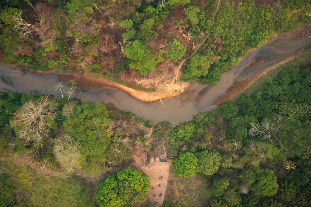
Article 64 of the MIT’s Autonomous Statute on Food Sovereignty establishes the protection of the components of the territory: water sources (rivers, streams, lakes, lagoons, swamp), the mountains and the pampas.
The conservation of this territorial space is not only in the hands of the MIT, since areas such as those occupied by the Chimán Indigenous Territory (CIT) and the Indigenous Territory and National Park Isiboro Sécure (Tipnis) have a fundamental participation in the comprehensive care of the forests of the department of Beni.
“The Eva-Eva mountain range, on one side, it is a Chimán Indigenous Territory (CIT), on another side, it is a protected area at the departmental level, and on the other side, it is a protected area of water reserve at the municipal level, that is, it has three categories. This area is the source of all the rivers of the MIT, from here all the springs are born. In other words, the water system of the MIT is absolutely dependent on the Eva-Eva mountain range; anything that happens to Eva-Eva influences the MIT and the CIT,” Rivadeneira described.
The Multiethnic Indigenous Territory notes the need to make joint efforts with the CIT, the Tipnis and the Eva-Eva-Mosetenes Watershed Protection Zone, which is a departmental protected area of Beni, since they are territories that depend on and influence each other.
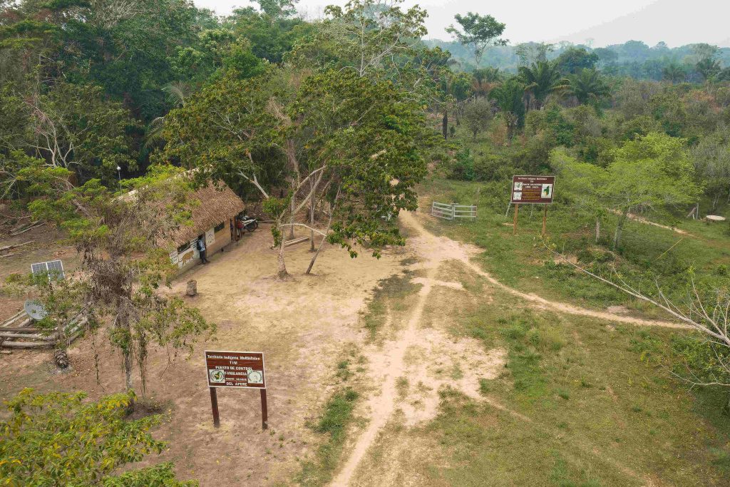
With the implementation of multiethnic indigenous self-government, it is expected that the Autonomous Indigenous Government of the MIT (AIG-MIT) will structure an Environmental Unit dedicated to managing conservation issues, based on information obtained from control and surveillance posts, such as those already operating in Monte Grande del Apere and Cuberene, which is planned to be extended to other strategic areas of the territory.
The TIM Governance (timgobernanzaterritorial.com) web portal has a regulatory compendium in which documents related to the Loma Santa Conservation Area and the AIG-MIT can be consulted online or downloaded. It also compiles maps of the MIT and territorial, management, control and surveillance information of the territory, a series of data that emerges from the checkpoints and that can eventually become tools for decision-making by the authorities of the new government.
This post is also available in:  Español