


A gravel road stretches from the exit of San Ignacio de Mojos, 95 kilometers from Trinidad (Beni) to Monte Grande del Apere, in the Multiethnic Indigenous Territory (MIT). The map shows 88 kilometers of travel, which inside Juan Bautista Zabala’s minibus becomes into almost two hours of travel, between clouds of dust, vegetation, and a thermal sensation of more than 40 degrees Celsius.
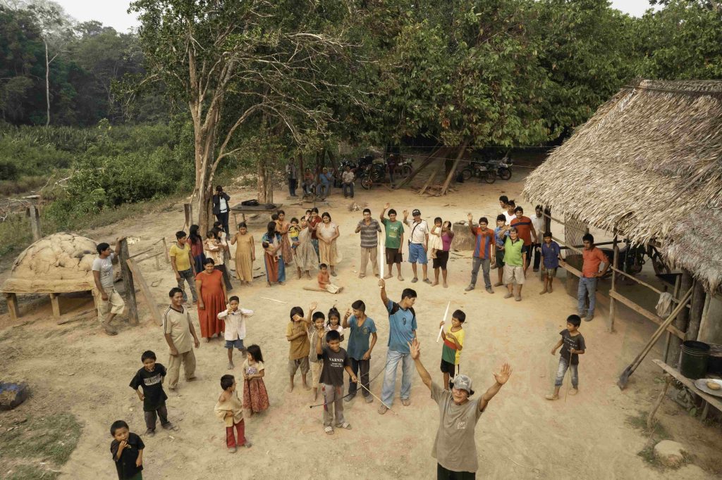
Since 2022, in this place, five villages – Mojeño-Trinitario, Mojeño-Ignaciano, Yuracaré, T’simane and Movima – make up the Autonomous Indigenous Government (AIG-MIT), whose top representatives – cacique and assembly members – were sworn in on November 10.
This is the first territorial indigenous autonomy of the lowlands of Bolivia and the fifth to be exercised in the country since the Political Constitution of the State recognized the right of these peoples to self-govern themselves in 2009.

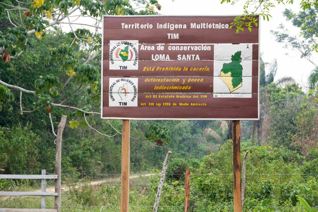
It’s November, full summer in this part of the continent. In Monte Grande del Apere is the gateway to the MIT conservation area called Loma Santa or place without suffering, “where you live in peace”, according to the worldview of the peoples.
“There are animals here, trees, rivers. It is a beautiful land, without suffering. That’s why it was called Loma Santa, a hill without evil, where our grandparents and their parents lived,” says Manuel Gualú, reeve of Monte Grande. This is how he describes this conservation area, which occupies 206,211 hectares of the more than 500,000 hectares of the MIT.
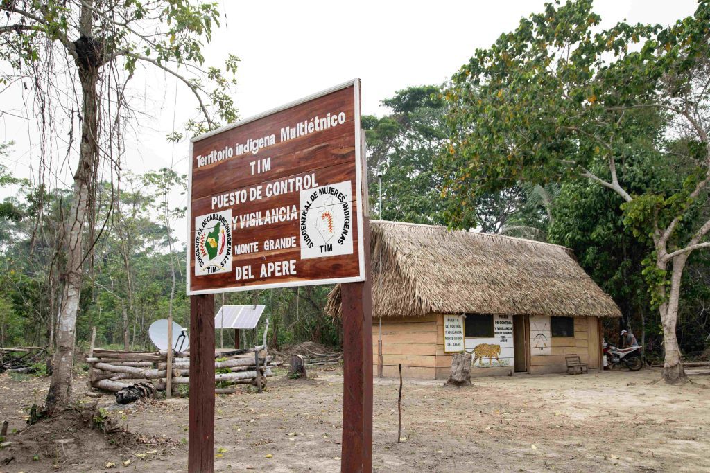
This territory, which already has its own autonomous government, is located west of Trinidad, capital of the department of Beni. Its margins begin 14 kilometers from the road that connects San Ignacio de Mojos with San Borja, and extend southwards, until it borders the Indigenous Territory and National Park Isiboro Sécure (Tipnis). On November 26, 2022, the magistrates of the 26 communities that make it up, in application of their own decision-making systems, created the Loma Santa Conservation Area.
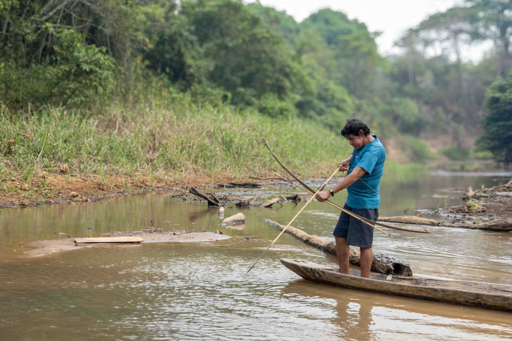
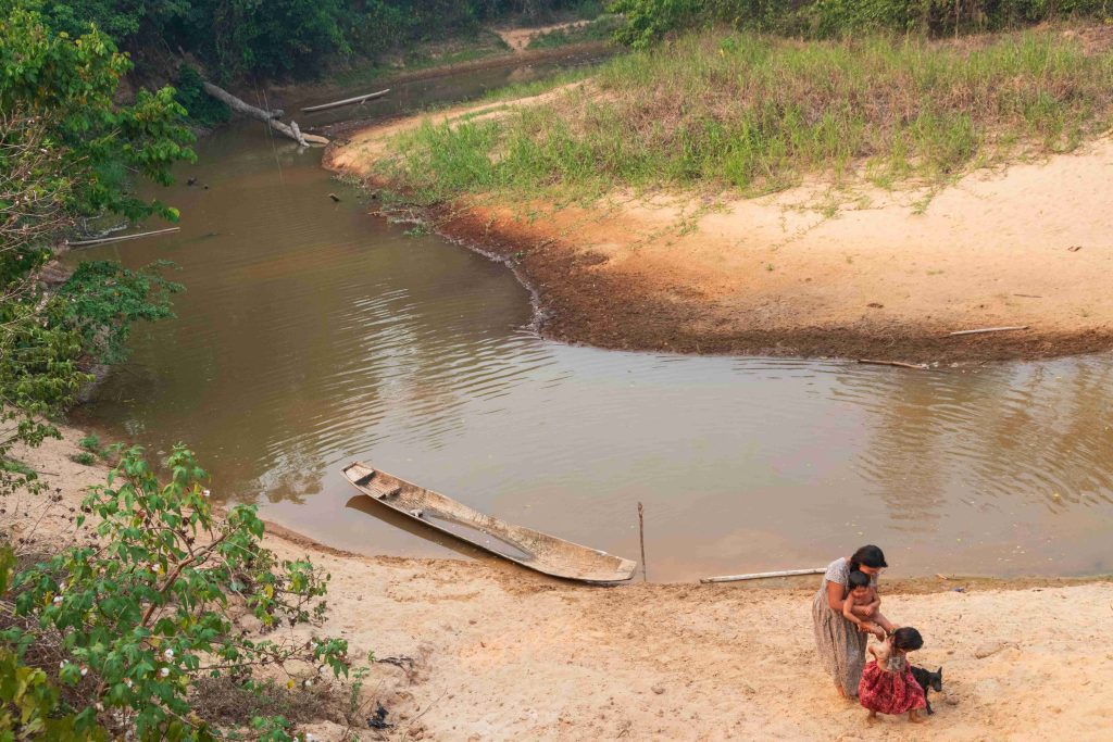
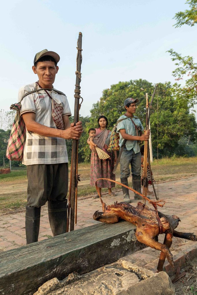
The life of the five villages of the MIT is possible thanks to hunting, fishing, and the fruits they receive from this land, and in particular from this region of the territory, where the fauna reproduces, and the waters are born. They know this and are aware that conservation depends on vigilance, and this, in turn, depends on the “guardians of the forest” that they formed to control entrance, exit and any unusual movement in Loma Santa.
From the Bottom Up: A Community-Based Control and Surveillance System
The MIT Control and Surveillance System is the result of the Plan for the Autonomous Management and Control of Natural Resources of the Sub-Central of Indigenous Councils and the Sub-Central of Indigenous Women. It began to be outlined in 2021 and consolidated in 2023, with the accompaniment of the Legal and Social Support Organization ORE.
Between access to water, health and education, which are matters of concern to the common villages of these lands, the preservation of their conservation area became a priority issue with the understanding that there is no culture without nature; nor nature without indigenous villages.
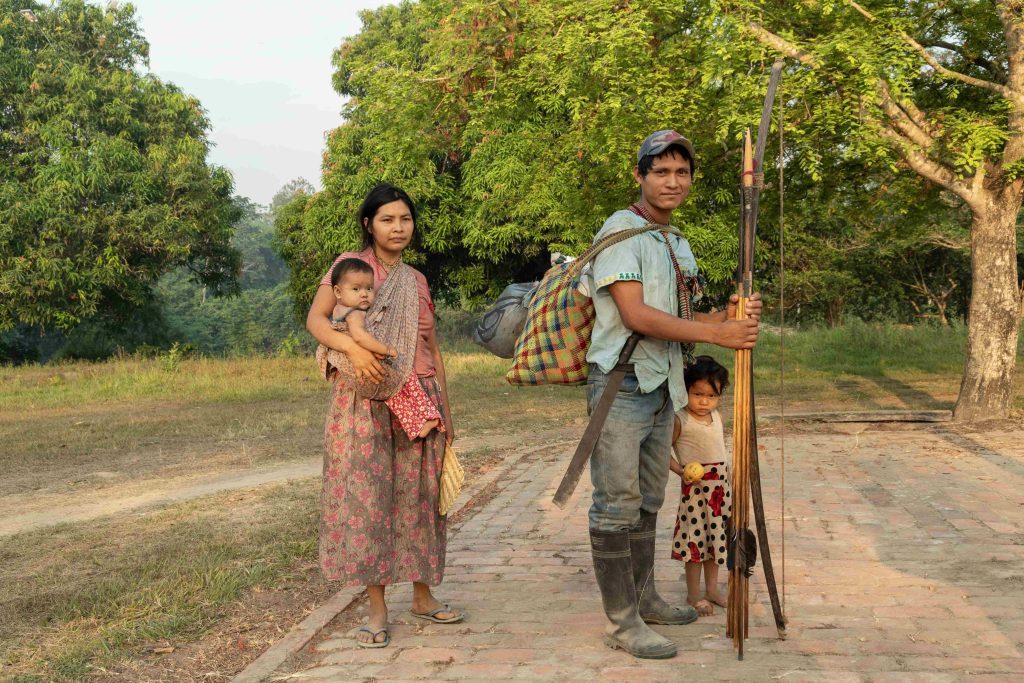
“The ĉocaityi’ därä judye ya’ jebacdye’ (a word in t’simane that translates as ‘the one who is taking care of the forest and the animals’) we call guardians of the forest. They are the same hunters of the community; A group of five people who, when they go hunting, take the opportunity to take a tour of the territory. They don’t earn a salary, but they sustain the community by bringing the meat they trade or sell; They go out hunting and roaming. If they see something strange, they notify the stallholder,” says the reeve of Monte Grande.
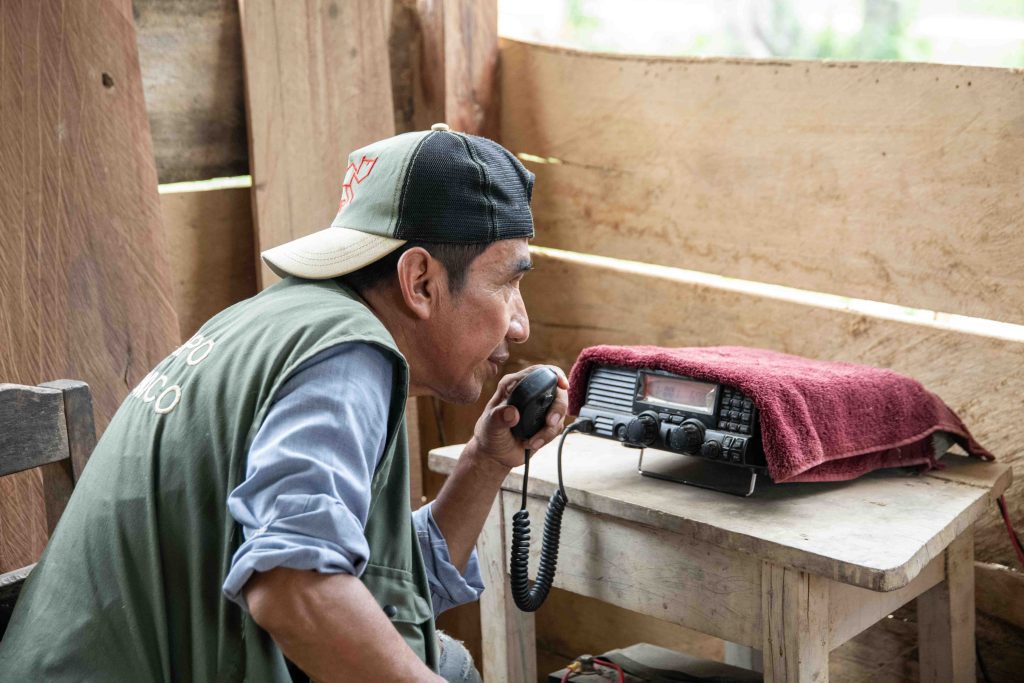
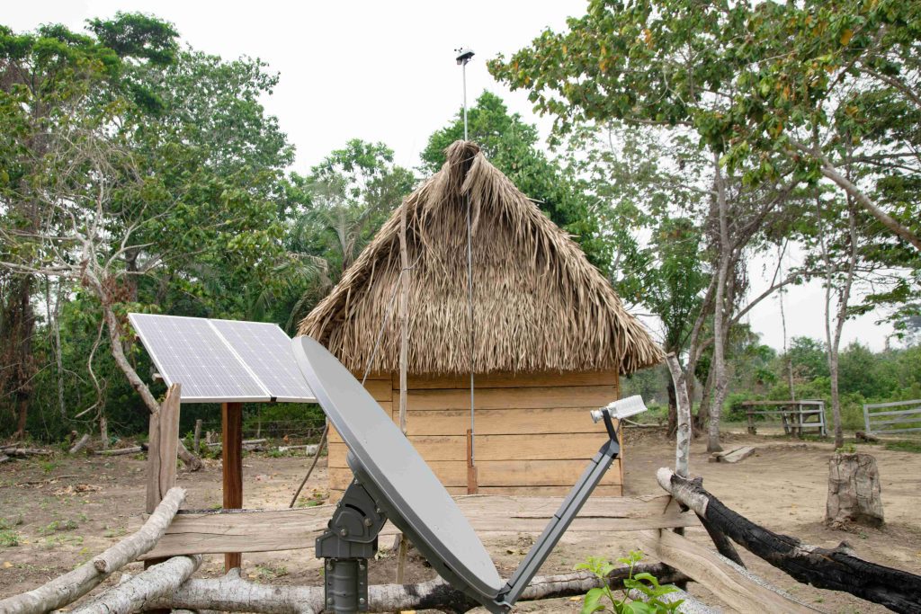
The implementation of this community-based control system meant integrating the inhabitants in the surveillance of their territory, without this task taking time away from their hunting activities and sustaining their peoples. This is complemented by the entry into operation of a checkpoint where, with the support of the NICFI Program of the Norwegian cooperation, satellite internet and a weather station were installed to monitor weather conditions, a tool that even makes it possible to report in time when there are emergencies such as a forest fire.
The reason is that the threats facing the entire territory have to do with illegal timber extraction, indiscriminate illegal hunting, and irregular settlements.
“This area is to protect, to maintain well, not to pollute, so that it is not lost. We are always going to be there to protect it from threats such as pollution, fires, from people from elsewhere who want to occupy it, to cross with a road, who want to take away the forest,” says Soilo Canchi, assembly member of the T’simane village.
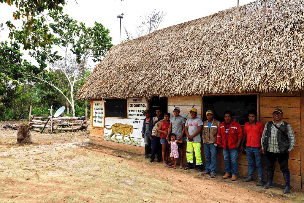
On August 25, in Monte Grande del Apere, the first checkpoint was inaugurated, which is linked to the communities of Jorori, San Salvador, Naranjal and Piñal, which border the Tipnis, a territory threatened by mining and subjugation. Hence, each of these communities chose five hunters (guardians of the forest) to report any irregularities in addition to registering their hunts for the food of their people.
“The relatives (as they call the T’simanes in the MIT) walk a day and a half, two days if it is with their children, to leave from Piñal, Naranjal or San Salvador del Apere,” says don Juan Bautista, the public transport driver.
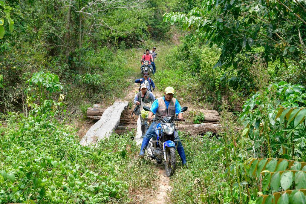
That journey is reduced to almost four hours on a motorcycle along a trail to get from Monte Grande to San Salvador del Apere, where Julián Tayo Canchi hunts to feed his family. Now, in addition, he is a watchman of the land that provides him with his food.
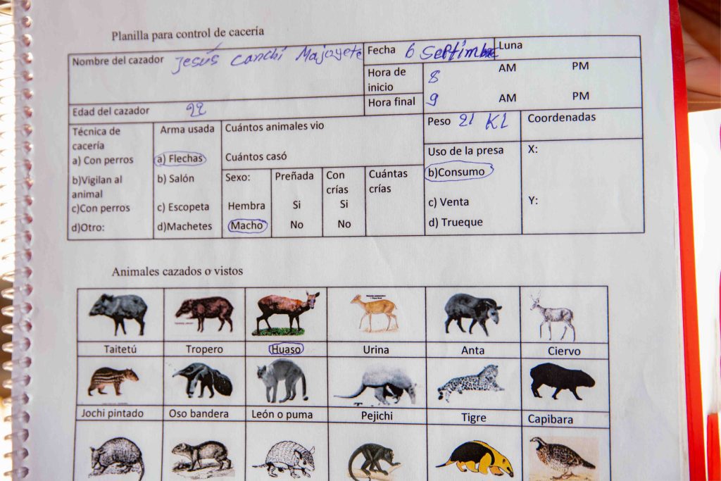
“We are taking care of our forest from people who come in from other places. We hunt for our own consumption, we hunt jochi, tropero, taitetú, anta (local species)… At first (filling out the hunting registration forms) it was difficult, but we are learning,” he explains, referring to some forms that ORE distributed, so that they can register their daily hunts, keep track, and realize that they may be exceeding the activity. For this reason, the organization and the locals are working on the development of a hunting calendar, which recovers ancestral knowledge.
Pedro Canchi Cárdenas is the reeve of San Salvador del Apere, an area vulnerable to timber logging. “People from San Borja came here looking for wood, which is what we take care of, along with our animals. This year we have agreed that if we catch a person (outside his/her territory), we will confiscate (what they have) so that they do not enter anymore,” he says.
Technology at the service of the people
The Monte Grande del Apere checkpoint has a system of solar panels that supply it with electricity. The Mojeño-Trinitarios who live in that community built a house with a space to install the weather station, from where the weather conditions of the region are monitored. With this equipment, the records of San Borja and San Ignacio de Mojos, which until recently provided approximate information from the MIT, are no longer needed.
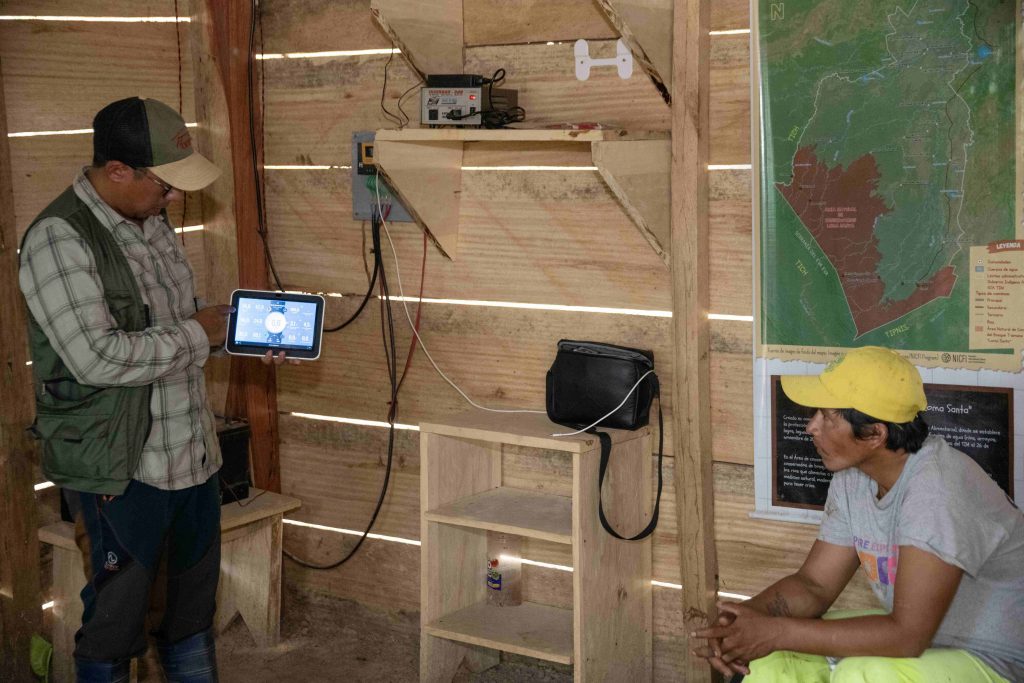
The checkpoint has satellite internet and includes a shortwave radio that communicates with the other communities of the MIT. The data provided by the station can be reviewed in real time and in a simple way through its high-tech console, whose operation is possible only with basic knowledge. This information is also available from the cell phone and it will be uploaded shortly to the MIT Territorial Governance — timgobernanzaterritorial.com— website and is reported to the Subcentral of Indigenous Councils.
ORE’s biologist, Miguel Fernández, explains that the system integrates two fundamental subsystems: the subsystem for the control of illegal activities within the area, which involves the loss of natural resources, and the subsystem for monitoring the quality of forests, rivers, and pampas of the MIT.
Likewise, Mario Cerezo, a technician at the institution, adds that the implementation of the technology has several edges: “On the one hand we have the implementation of the weather station and the internet at the Monte Grande Control Post, but also the development of the MIT’s Territorial Governance web platform; An application for inspections, reports and for hunting control. We developed two ways of collecting data for the guardians of the forest: one, using applications on cell phones for those who have internet, know how to read and write, and another for those who do not have that available, for them physical spreadsheets have been designed.”
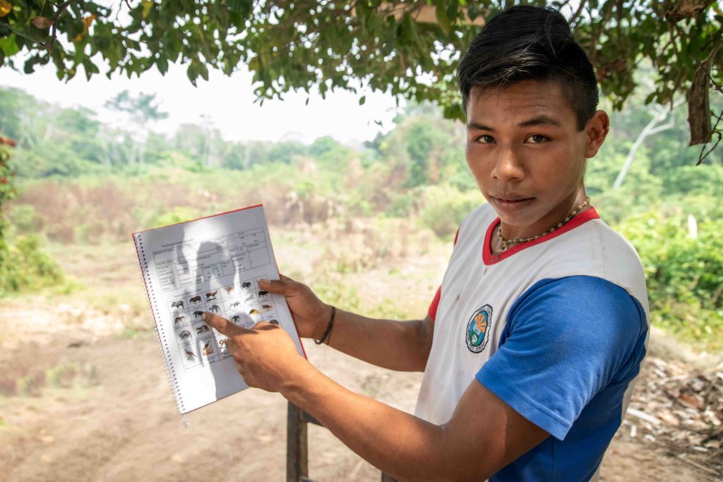
The physical worksheets consist of a notebook with illustrations of the animals that inhabit Loma Santa. When the hunters return from their work in the forest, they mark on the sheet the drawing of the animal they hunted, with additional data such as weight, approximate age, and gender, among others. The information contained in these physical spreadsheets will allow the data to be tabulated on the cell phone, and then the hunting calendar of the MIT communities will be drawn up, data that will be uploaded to the Governance website.
“These forms are simple; many hunters already fill them out. They hunt, they come home, and they look at these little drawings to see what animal they have hunted, and they mark it. They fill in their box, they put how much it weighs, it is important to know how much meat is consumed per week, the amount of meat that hunter provides to the community. Regarding the calendar, they tell us when the females are pregnant, that serves to recover the ancestral hunt, because before they told us: ‘In May we will not hunt females because they are with calves’; this form is used for this control”, adds Severiano Matenes, a Mojeño Ignaciano, inhabitant of the Natividad del Retiro community, currently a zonal technician at ORE.
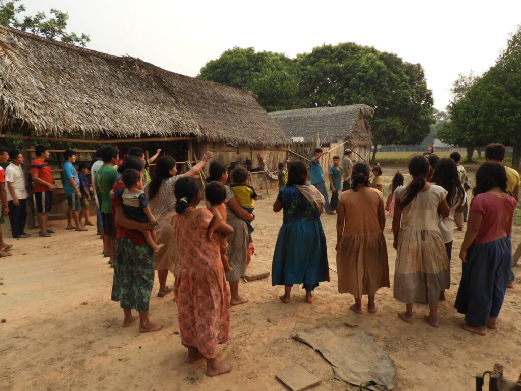
The installation of the checkpoint meant the meeting of parents and children, teachers, and students of the promotion of the Monte Grande school, where the students drew and painted the jaguar next to the legend: “Monte Grande del Apere Control and Surveillance Post”. The community works together for the same goal: the preservation of its conservation area.
“Here, in Monte Grande, a cell phone was assigned to one of the guardians of the forest, Mr. Basilio, he is helped by his wife and daughter, young people handle cell phones better, and we saw that this is a very interesting opportunity for intergenerational encounters. Sometimes the elders are the only ones involved in the problem of the territory, but when we include young people, we make them aware of the future of their land and how they can contribute to the development of their community,” says Cerezo.
This checkpoint has already been replicated in Cuberene, a town in the MIT bordering the Chimán Indigenous Territory (CIT). The idea is to consolidate a post, expand its coverage at strategic points, have local rangers and ensure the sustainability of the checkpoints.
The Importance of Sustainability
ORE managed resources for the installation of the checkpoints and their equipment, in addition to the training of forest guardians, stallholders and local teachers, who were instructed to navigate the MIT Governance website, so that they know how to identify the multimedia resources it has and can read the maps available on the platform. The aim is for them to share this knowledge with children and young people in the communities.
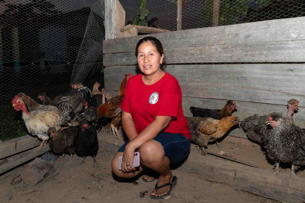
The institution stated that for the control and surveillance posts to fulfill their function in the territory, they must be sustainable, so that the stallholder can do his job and at the same time support his family. To this end, there is the commitment of the organizations of the territory such as the Subcentral of Cabildos and the Subcenter of Women, which support in the management and implementation, to add to the control post a chaco and amenities for the family of stalls, who upon entering the house will also receive chickens, with whose breeding some type of income will be generated during their stay as responsible for the control center.
“It has taken us a while to think about how we can achieve the sustainability (of the checkpoints), so that a stallholder can be encouraged to go two years without pay. We sat down with the Subcentral to think about what could work, so we equipped the checkpoint with an office, a space for the family to live, with its kitchen and a bathroom, as well as a farm to produce cassava, corn, the basics. We planted the seed, but the community is going to be in charge of planting, producing, and growing the chickens that we have delivered,” says the coordinator of the project, Catalina Rivadeneira.
“As a Women’s Subcentral, we support the breeding of chickens and laying hens, we also train the people who are going to be as landlords and guards, so that they know how these animals are maintained. ORE gave us 50 chicks; they have all survived and at six months the hens started laying eggs. With these 50 we can only see that there is no shortage of eggs to sell and feed ourselves. For the community this seemed impossible, but with the talks and workshops given by the institution and the two sub-centers, we have seen how we can help to activate the checkpoints,” says Petronila Ipamo, secretary of the Education and Health portfolio of the Sub-Central of Indigenous Women.
The inhabitants of the MIT took ownership of the institution’s approach and began to develop the idea until it became a reality. At the end of two years, once their tenure as stallholders is over, the family of guards must hand over the seed capital to those who take their place. But, when they leave, they will be able to take with them the surplus of the animals they raised.
Behind it will also be the checkpoint and surveillance, with the house and its chaco, ready for a new family to work it to live and guard the activity at the entrance to Loma Santa, that land without evil, where people live in peace, on which the almost 5,000 inhabitants of the Multiethnic Indigenous Territory of Beni depend.
This post is also available in:
![]() Español
Español